Paozilun and Daqiling trails in Shenkeng
This blog has a few reviews of hikes to go on for a day trip if you head down to Shenkeng old street of Shiding. Both towns are great to see if you're ready to spend a day touring around the mountains south of Taipei. The two trails featured here are within easy walking distance from the river and old street in Shenkeng, and are actually part of the same set of (partially) linked hiking paths. If you're really in the mood you can walk up and over the mountains here and get to Maokong Station on the gondola which runs behind the Taipei zoo.
To save 99% of readers time, the final conclusion of this entire article is you should avoid these hikes unless you've a) done all the hikes in Taipei already, or b) are doing it in winter and are a genuinely avid hiker with a good understanding of how to use your phone's GPS. These hikes are not suitable for casual walks on a date, or for people just looking to stretch their legs.

I set out to do this hike on the first of those hot humid spring days where the sun is out drying up a week full of rain. The trails were slippery and wet, at times bordering on a giant mud puddle, and the air was humid and close. It wasn't ideal hiking weather to say the least, but I went prepared with water and light, breathable hiking clothes that would keep the season's mosquitoes away. It's always a good idea to cover up when you hike in Taipei, but especially so on this hike.


The trails were all incredibly narrow, at times hardly visible through the underbrush, but hiking groups had hung their trail marking flags periodically so you knew where to go. Insects and spiders were everywhere, and I found more than a few bugs clinging to my pants when I got back to the road. If you don't like swatting your way through cobweb lined trails, beating away snakes and insects, you probably won't like the rustic hikes south and west of Shenkeng.

The Daqiling trail starts just off the road from the Formosa gas station, tucked behind a shed on your right. Eventually the road gets called Arouyang Industry Road, and if you follow the daqiling trail you'll end up at the top of the peak which leads to Maokong. The hike is rather steep, and while there are old worn out steps they are quite slippery and not super useful, so expect to do this hike on the bare dirt and mud. The trail is marked regularly, but the maps you find on the trail are not super useful. Just stay left at the forks in the road, and you'll make it up to the top.

Once you reach the top you'll turn right and uphill on the road, go around a hairpin turn and then turn right down a very old concrete looking road. It runs slightly downhill and eventually turns into a trail which lets out near Maokong station. This is a good way to go if you want to see Shenkeng for lunch and then do a sunset view over the city from Maokong somewhere.
Paozilun has a trail which leads up to the top of an adjacent mountain to the Daqiling trail, and also features a waterfall of the same name. Again the trail is very overgrown at the lower levels, and is at times poorly marked.


Despite what appears to be a continuing series of trails on the maps found at Daqiling, the Paozilun trail is accessed from a nearby road which passes behind a driving range and golf shop. Follow the main road uphill and you'll soon come along a very picturesque river. As you follow the river uphill you will eventually come to a fork in the main road. Heading to the right takes you to the Paozilun trail, and left goes up a steep road which eventually ends at a trail which leads to the waterfall.
Confusing, right?
I didn't even make it to the waterfall on this trip. I was too hot, too tired, and too unhappy at the horribly marked, narrow, bug filled trails. Photos on the internet seem to say it's pretty though. The Paozilun trail was largely unremarkable, and while there was apparently a view from the top, it was clouded over on the day I went so I didn't see a single thing. You can follow the road from the top of the hill back down to the main road which eventually leads up to the Taipei Zoo after a lengthy walk.
Get to the base of these hikes by walking from Shenkeng, which is gotten to by bus from Muzha station, by taking a short bike ride from the U bike station across from the same MRT stop, or drive a car or scooter. You can make it to Maokong or the Taipei Zoo, but unless you've got plenty of time to get lost - plus plenty of water - it's suggested you just skip these hikes all together.
To save 99% of readers time, the final conclusion of this entire article is you should avoid these hikes unless you've a) done all the hikes in Taipei already, or b) are doing it in winter and are a genuinely avid hiker with a good understanding of how to use your phone's GPS. These hikes are not suitable for casual walks on a date, or for people just looking to stretch their legs.

I set out to do this hike on the first of those hot humid spring days where the sun is out drying up a week full of rain. The trails were slippery and wet, at times bordering on a giant mud puddle, and the air was humid and close. It wasn't ideal hiking weather to say the least, but I went prepared with water and light, breathable hiking clothes that would keep the season's mosquitoes away. It's always a good idea to cover up when you hike in Taipei, but especially so on this hike.

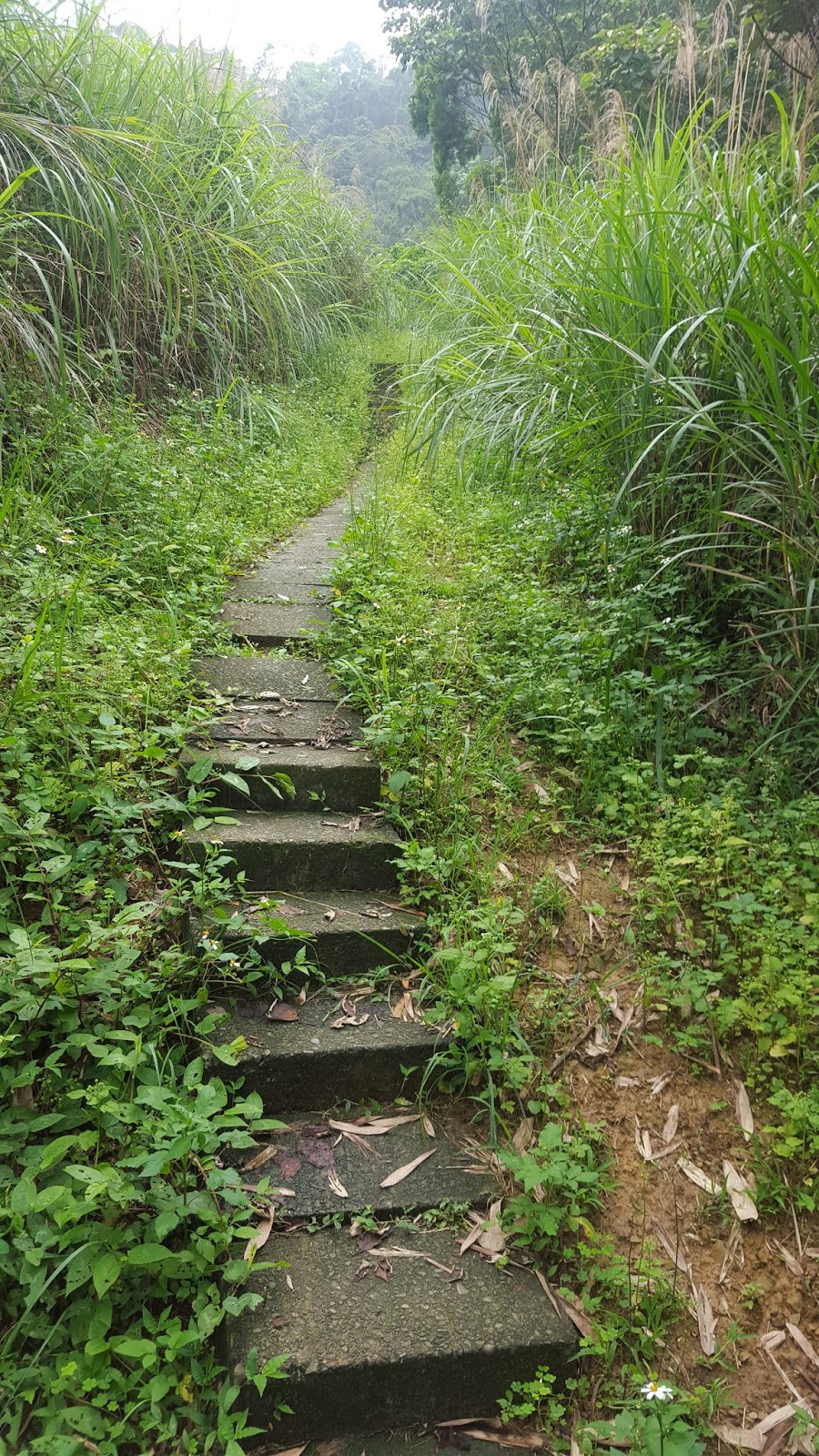

The trails were all incredibly narrow, at times hardly visible through the underbrush, but hiking groups had hung their trail marking flags periodically so you knew where to go. Insects and spiders were everywhere, and I found more than a few bugs clinging to my pants when I got back to the road. If you don't like swatting your way through cobweb lined trails, beating away snakes and insects, you probably won't like the rustic hikes south and west of Shenkeng.

The Daqiling trail starts just off the road from the Formosa gas station, tucked behind a shed on your right. Eventually the road gets called Arouyang Industry Road, and if you follow the daqiling trail you'll end up at the top of the peak which leads to Maokong. The hike is rather steep, and while there are old worn out steps they are quite slippery and not super useful, so expect to do this hike on the bare dirt and mud. The trail is marked regularly, but the maps you find on the trail are not super useful. Just stay left at the forks in the road, and you'll make it up to the top.

Once you reach the top you'll turn right and uphill on the road, go around a hairpin turn and then turn right down a very old concrete looking road. It runs slightly downhill and eventually turns into a trail which lets out near Maokong station. This is a good way to go if you want to see Shenkeng for lunch and then do a sunset view over the city from Maokong somewhere.
Paozilun has a trail which leads up to the top of an adjacent mountain to the Daqiling trail, and also features a waterfall of the same name. Again the trail is very overgrown at the lower levels, and is at times poorly marked.


Despite what appears to be a continuing series of trails on the maps found at Daqiling, the Paozilun trail is accessed from a nearby road which passes behind a driving range and golf shop. Follow the main road uphill and you'll soon come along a very picturesque river. As you follow the river uphill you will eventually come to a fork in the main road. Heading to the right takes you to the Paozilun trail, and left goes up a steep road which eventually ends at a trail which leads to the waterfall.
Confusing, right?
I didn't even make it to the waterfall on this trip. I was too hot, too tired, and too unhappy at the horribly marked, narrow, bug filled trails. Photos on the internet seem to say it's pretty though. The Paozilun trail was largely unremarkable, and while there was apparently a view from the top, it was clouded over on the day I went so I didn't see a single thing. You can follow the road from the top of the hill back down to the main road which eventually leads up to the Taipei Zoo after a lengthy walk.
Get to the base of these hikes by walking from Shenkeng, which is gotten to by bus from Muzha station, by taking a short bike ride from the U bike station across from the same MRT stop, or drive a car or scooter. You can make it to Maokong or the Taipei Zoo, but unless you've got plenty of time to get lost - plus plenty of water - it's suggested you just skip these hikes all together.


Comments
Post a Comment